NOAA Fully Prepared for Hurricane Season
"Jason-3 and Jason-2 will provide valuable information for forecasters this hurricane season. These satellites can identify high-standing pools of warm water that fuel the explosive growth of tropical storms," said Stephen Volz, Ph.D., assistant administrator for NOAA's Satellite and Information Service
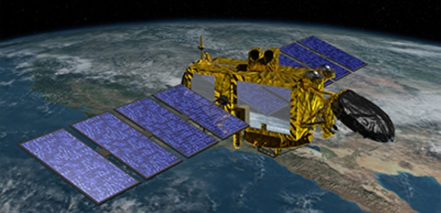
The National Oceanic and Atmospheric Administration assumed control last week of the Jason-3 satellite, the latest in a series of spacecraft that monitor sea-level rise and help the National Weather Service more accurately forecast the strength of tropical cyclones. During this year's Atlantic hurricane season, Jason-3 and its predecessor, Jason-2, will arm NOAA with twice the amount of satellite data, including vital ocean temperature information, that is used to predict if and when a storm will strengthen.
NOAA's release said the two satellites will begin flying alternating orbits by October; Jason-3 was launched Jan. 17 and has completed a six-month phase to test the instruments in orbit. It is flying in a low orbit 830 miles above the Earth, with its radar altimeter monitoring 95 percent of the world's ice-free oceans every 10 days. "Since the start of the TOPEX/Poseidon mission in 1992, and continuing with the Jason satellites, researchers have observed global sea-level rise at a rate of 3 mm a year, resulting in a total change of 70 mm — or 2.8 inches — in 23 years," according to the agency.
"Jason-3 and Jason-2 will provide valuable information for forecasters this hurricane season. These satellites can identify high-standing pools of warm water that fuel the explosive growth of tropical storms," said Stephen Volz, Ph.D., assistant administrator for NOAA's Satellite and Information Service, which is leading the Jason-3 international mission in which NOAA collaborates with NASA, the Centre National d’Etudes Spatiales (CNES, the French Space Agency), and the European Organisation for the Exploitation of Meteorological Satellites.
Data from Jason-3 has other uses: ocean wave height modeling for commercial vessel operators; forecasting currents for commercial shipping and ship routing; coastal forecasting for response to environmental challenges, including oil spills and harmful algal blooms; coastal modeling; and El Niño and La Niña forecasting.