Data-Driven Insights on the California Drought
A newly released interactive California Drought visualization website aims to provide the public with atlas-like, state-wide coverage of the drought and a timeline of its impacts on water resources.
- By Ethan Alpern
- Dec 08, 2014
The U.S. Geological Survey developed the interactive website as part of the federal government's Open Water Data Initiative. The drought visualization page features high-tech graphics that illustrate the effect of drought on regional reservoir storage from 2011-2014.
For the visualization, drought data are integrated through space and time with maps and plots of reservoir storage. Reservoir levels can be seen to respond to seasonal drivers in each year.
However, available water decreases overall as the drought persists. The connection between snowpack and reservoir levels is also displayed interactively. Current streamflow collected at USGS gaging stations is graphed relative to historic averages. Additionally, California’s water use profile is summarized.
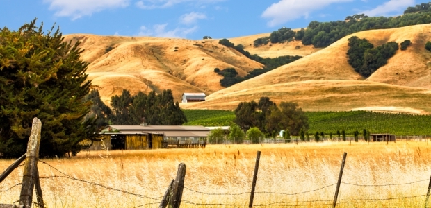
California has been experiencing one of its most severe drought in over a century, and 2013 was the driest calendar year in the state's 119-year recorded history. In January, California Governor, Jerry Brown, declared a State of Emergency to help officials manage the drought.
"USGS is determined to provide managers and residents with timely and meaningful data to help decision making and planning for the state's water resources," said Nate Booth, chief of USGS Water Information. "The drought affects streamflow across the state, which leads to reduced reservoir replenishment as well as groundwater depletion."
White House open data policies continue to provide opportunities for innovation at the nexus between water resource management and information technology. The Open Water Data Initiative promotes these goals with an initial objective of presenting valuable water data in a more user friendly, easily accessible format.
"Ultimately, the initiative will allow us to better communicate the nation's water resources status, trends and challenges based on the most recent monitoring information," said Mark Sogge, USGS Pacific regional director. "By integrating a range of federal and state data to communicate the extreme circumstances of the water shortage in California and the southwest, USGS is providing for public use a rich and interactive collection of drought related information."
"The state and federal data presented are publicly available, as is the open-source software that supports the application," said Emily Read, a USGS developer of the website. "The application allows the public to explore the drought not only as we’ve presented it, but because the software is open-source, anyone can easily open up the data and expand the story."
In addition to this new visualization website, the USGS California Water Science Center has an extensive portal dedicated to the California drought, the state’s water resource information, and more.
About the Author
Ethan Alpern is the Public Affairs Specialist at the Office of Communications and Publishing for the U.S. Geological Survey.