Under Surveillance
A growing Florida county utility uses high-tech markers to see underground
 The Wastewater Operations Division of Charlotte County Utilities in Charlotte County, Fla., operates in a unique underground construction setting. The county is in the process of substantially expanding its utility infrastructure to serve thousands of platted residential lots and accommodate the demands of rapid population growth.
Charlotte County lies on the central Gulf Coast of Florida and encompasses the Greater Port Charlotte area. This is one of the fastest growing counties in the state of Florida; from 1970 to 2003 the county's population grew from 27,000 to 150,000.
The County Utility department currently serves approximately 50,000 homes and businesses in the Greater Port Charlotte area.
Hidden Challenges in Florida
"We have a novel situation in Charlotte County," said Utility Engineer Mike Saunders. "Beginning in the 1950s and peaking in the early 1980s, a large development firm platted several hundred-thousand residential lots in our area, many located on canals with boat access to Florida waterways. However, these lots could not be developed because county deed restrictions prevented owners from building homes in the absence of municipal sewer facilities.
"The county recently assumed responsibility for this task, and we are presently placing sewer and water lines to these residential lots on a phased basis."
Each phase of the construction process involves 250,000 feet or more of buried pipe, Saunders said, and the field setting is somewhat challenging because of the number of canals and the resulting complexity of the network. Like most of Florida, the water table in Charlotte County is just 4 feet to 5 feet below grade, limiting buried utilities to a depth of 3 feet or less.
Marking and Locating Buried Facilities
"High moisture levels and soil conditions in our area present serious corrosion problems for tracer wires, and they are also vulnerable to damage and often left un-repaired, making them a poor long-term resource for marking routes," Saunders said. "The Wastewater Operations Division began using passive underground markers several years ago to trace utility routes and pinpoint the location of underground features and found this to be a workable marking alternative for long-term support of maintenance and repair, at relatively modest cost. An advanced level of underground marking technology was introduced about the time we were planning our first phase of the current water and sewer installation project.
"With these newest markers, a user can not only quickly locate an underground point, but also read useful digitized information about the site that has been stored on the marker. Given the proven value of the earlier passive markers, it was decided to adopt the newer active devices for this large construction project as a means of improving future safety, convenience, and department efficiency."
ID markers are 4-inch diameter plastic balls containing non-powered electronic circuits that can be buried and programmed in the field with information about each location. These devices are located and read with hand-held locators that communicate by means of utility-specific radio frequency signals. Such markers can be used in combination to support resource management for every category of underground facility.
Active ID markers incorporate an Application-Specific Integrated Circuit (ASIC) chip to store static information. Each active underground marker has a unique factory-assigned serial number that can be associated with that location and transferred to as-built buried-facility drawings for future reference. The markers can also store 24 bytes of custom data that can be written to the chip by the user anytime before a marker is placed in the ground. ID markers require no external or internal source of power and are energized solely by electromagnetic energy received from the interrogating marker locator.
Ball markers are programmed, located, and read by means of a multi-purpose locator. In addition to marker locating, these battery-powered device incorporate features for underground facilities management, including tracing cable and pipe paths and locating faults. In the Alert mode, a user is able to identify and read ID markers during a cable/pipe trace operation. An RS232 communications port allows it to interface with an external computer to download and upload marker information for record managements and mapping.
The Underground Marking Process
"When a marker ball is placed, we program important details into its memory, including the pipe type and size, the year of installation, fitting type, and depth below the surface," Saunders said. "In the future we may also record GIS mapping data and even GPS coordinates, although that has not been deemed necessary for the time being."
According to the Charlotte County spokesman, the utility is placing the new active-ball markers at 150-foot intervals to define underground pipe routes in the new construction zone. This allows for easy access to sewer and water lines at any intermediate point with pinpoint accuracy. Key utility features, such as pipe deflections, Ts, junctions, service points, and other significant points are also marked in this fashion.
When a marker locator sends out a search signal, the buried marker responds with stored data, which is displayed on the locator panel. Unlike earlier passive devices, the new active ID marker system can differentiate every marked underground feature, and it can even distinguish the facilities of competitors having adjacent markers that are tuned to the same frequency. Individual marker frequencies and colors are supplied for each of seven underground utilities -- cable TV, gas, telephone, wastewater, water, power, and general purpose categories.
"Marker locating is so precise that we can excavate accurately with a tool as small as a post-hole digger," Saunders said. "And since file photos are taken of the excavated site when marker balls are placed, returning workers will know exactly what to expect before they dig."
The county uses multi-layer geographic information systems (GIS) mapping for resource management, and the Wastewater Operations Division maintains a utility data layer on the GIS database. As-built utility records are also maintained on an AutoCAD system, with ID marker locations included in field records.
The Florida engineer explains that the efficiency of the ID marker system coupled with the shallow depth of buried markers makes it possible for a Charlotte County crew to detect markers, usually without even leaving their truck. Users simply advance the sensitivity of receiver units to sense the presence of a device and then turn down the gain and walk the area to pinpoint a marker's location.
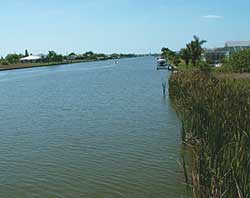
While most utility lines parallel roads in Charlotte County, it is occasionally necessary to run facilities beneath canals. State environmental regulations require a minimum of 10 feet of separation between the bottom of a waterway and the top of sewer pipes to avoid the possibility of dredge damage, so directional boring must be used for such crossings. Saunders said that bores are sometimes as deep as 30 feet below the surface. ID markers are used to mark bore transition points from PVC to polyethylene and back at both sides of a canal. Flexible polyethylene pipe is used for these bore segments because of its toughness and it has no joints.
"The complexity and value of underground services continues to grow in Charlotte County, with power, communication, and utilities services often sharing limited rights of way," Saunders said. "We're dealing with particularly congested facilities in some areas of the county, and need to be able to accurately sort out below-grade structures. Charlotte County does 2,000 locates every month, and this represents 2,000 opportunities per month for water and sewer facilities to be hit and damaged.
"Accurate, detailed, and timely utility records are increasingly important for maintaining damage-free utility operation. The ID marker system addresses that challenge and sets the stage for more efficient locating in the future."
This editorial originally appeared in the January/February 2006 issue of Water & Wastewater Products, Vol. 6, No. 1
This article originally appeared in the 01/01/2006 issue of Environmental Protection.
About the Author
Corey M. Willson works for 3M Test & Measurement Solutions BSME, University of Texas in Austin, Texas. He has 16 years experience in the manufacturing and application of underground marking and remote locating and test technologies in utility applications including water and waste water, natural gas, telecommunications, electrical power and CATV. He can be reached at 512-984-2694.